During the 2023 legislative session, Minnesota invested over $100 million in a Climate Resiliency and Water Infrastructure Grant Program for local and tribal governments. Some of the local entities tapping into those funds this spring include the Carnelian-Marine-St. Croix Watershed District, Comfort Lake – Forest Lake Watershed District, and Ramsey-Washington Metro Watershed District.
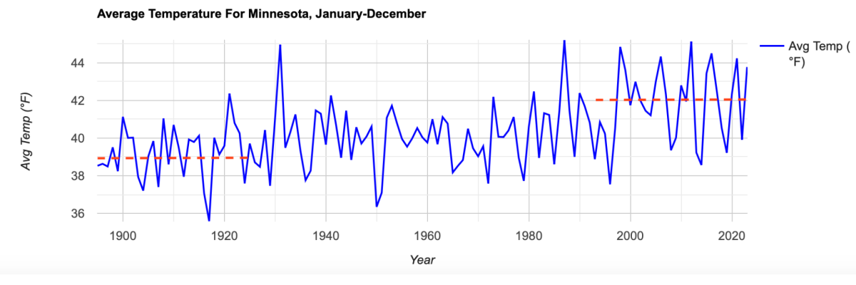
Climate data gathered from weather stations around the state (1895 to 2020) show that Minnesota’s average annual temperature has increased 3°F and we’re also seeing an extra 3.4 inches of precipitation each year (See Minnesota DNR – Climate Trends). This warming trend is most pronounced during the winter, with average minimum daily temperatures up by 6°F. As a result, there are three weeks less of ice coverage on Minnesota lakes, compared with 100 years ago.
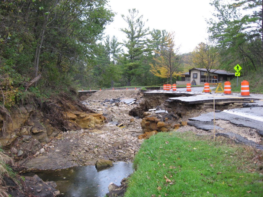
We’re also seeing marked changes in how precipitation happens. In recent years, Minnesota has cycled rapidly between flooding and drought conditions. Meanwhile, “mega rains” that drop more than 6-inches of rain across more than 1000 square miles have become four times more common since 2000.

In northeastern Washington County, the Carnelian-Marine-St. Croix Watershed is using a $50,000 grant from the Minnesota Pollution Control Agency (MPCA) to update the district’s hydrologic and stormwater models to account for new rainfall patterns. The watershed district is also working with its communities – Stillwater Township, May Township, Marine, and Scandia – to identify vulnerable infrastructure, such as under-sized culverts and pipes or roads at risk of flooding. Comfort Lake – Forest Lake Watershed District is completing a similar risk assessment with the communities of Forest Lake and Wyoming.


In St. Paul, the Ramsey-Washington Metro Watershed District is focusing its attention on a flood-prone neighborhood, known as Roosevelt Homes, where periodic flooding inundates the playground, parking lot, and maintenance facility. Established in 1951 as federally-funded low income public housing, this 23-acre property on Ames Avenue is home to 547 residents. Prior to receiving a MPCA Climate Resiliency Grant, Ramsey-Washington Metro Watershed District had already completed several flood-prevention projects in the neighborhood, including at a nearby school, at the Eastside Boys and Girls Club, and at the Roosevelt Homes property. Phase three, made possible by the new grant, will be used to improve drainage infrastructure and redirect water flow from a nearby road to better protect the parking lot, buildings, and maintenance facility. Once completed, these improvements are expected to significantly reduce flood risks, lowering water levels by 7 feet during a 10-year rainfall event.
