“In late January 1966, a man was found dead on Washington Mall in a mid-season blizzard. He had no family, left no will, and despite being 83, was on his way to work when he died,” writes Lori Williamson in the September 9, 2008 edition of the Minnesota Historical Society’s Collections Up Close blog. The man, Francis J. Marschner, was a skilled map-maker who laid the groundwork for natural resource management in Minnesota today, even though he never actually visited our state.
The story of Minnesota’s first land cover maps, often referred to as Marschner Maps, began in 1847 when the federal government sent survey teams out to Minnesota prior to opening the state to land sales and European settlement. Over the next 60 years, the surveyors recorded every forest, field and lake in painstaking detail. Later, in 1931, Marschner used the survey notes to construct detailed maps showing what Minnesota looked like before modern development began.

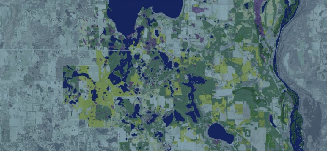
In 1998, the Minnesota Department of Natural Resources began updating Marschner’s Maps using a modern digital mapping system known as the Minnesota Land Cover and Classification System (MLCCS). The system uses aerial photos to code land cover across the state in ½ hectare units. These records are computerized for easy use, unlike the handwritten notes from Minnesota’s first land surveys, which are stored on yellowed paper at the Historical Society.
“You can learn a lot about the way our county has changed in the past ten years,” says Aaron DeRusha a senior technician at Washington Conservation District, who recently updated Washington County’s MLCCS data. Of note, the county saw a net loss of more than 6000 acres of cropland between 2005 and 2016, mostly due to development. 1973 acres of that cropland became low, medium or high density development and another 1459 acres was reclassified as “in transition,” meaning it had been graded for development but not yet built or was being actively mined.
In addition to using MLCCS data to describe and quantify our changing landscape, Washington County also uses its land cover maps to identify high-quality habitat and sensitive natural resources to protect through its Land and Water Legacy Program. County staff can then reach out to landowners and organizations to purchase land for protection or establish conservation easements on private land, using special funds approved by voters in 2006.
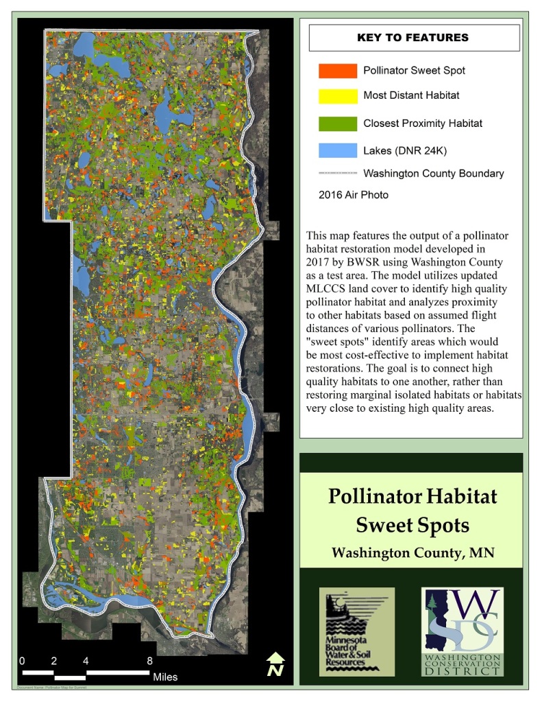
According to DeRusha, Washington County is one of the only counties in the state with a complete MLCCS dataset, making it an ideal location for piloting statewide efforts as well. For example, Board of Water and Soil Resources (BWSR) worked with Washington Conservation District in 2017 to identify existing pollinator habitat as well as “sweet spots” for restoration efforts. “These new maps highlight the places in Washington County where we could best allocate resources to connect and expand existing pollinator habitat,” explains Dan Shaw, a senior ecologist with BWSR. With Washington County complete, BWSR is now expanding its pollinator mapping project into Dakota, Hennepin and Ramsey Counties.
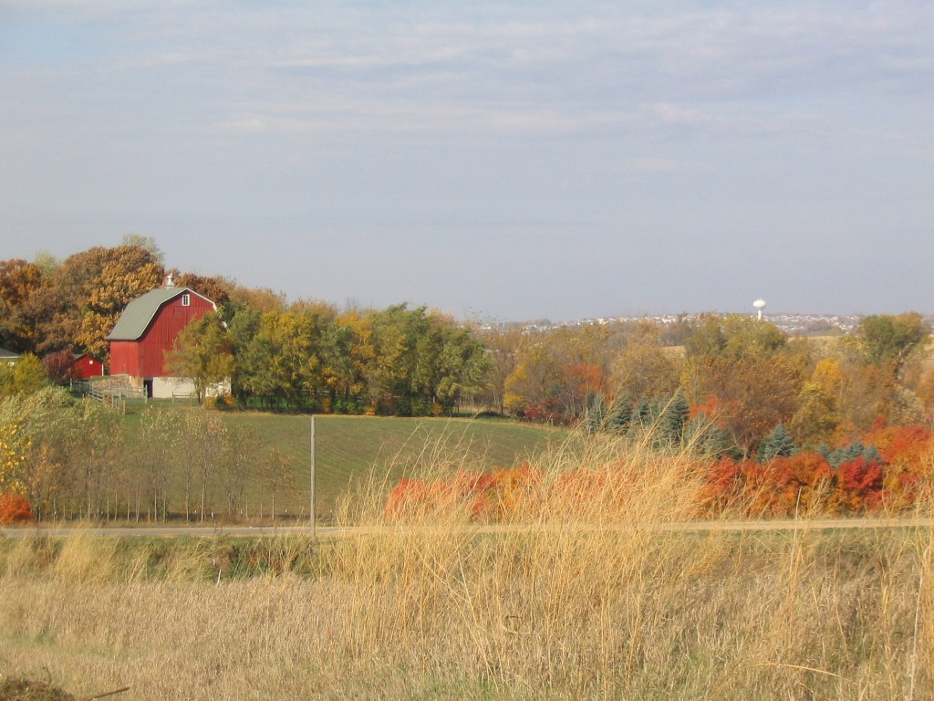
Though technology has changed almost as much as Minnesota’s landscape since 1847, modern mapmakers like DeRusha still have a fair amount in common with those early land surveyors. “It can be hard to tell the difference between a hayfield, a prairie, and a pasture in an aerial photo,” he says. When that happens, he puts on his boots and heads out in the field to find out.
