It was February 2020, and staff and officials from local communities were packed into a room at the Washington County Government Center, some sitting on the floor, others leaning against the back wall with notebooks propped against their stomachs. The group was in full-on crisis preparation mode, thinking not about COVID, but rather, the coming snow melt and potential for widespread flooding across Washington County.
Within a month, of course, a novel virus had arrived in the United States and with it, closed schools, closed restaurants, and overflowing hospitals. Amidst the chaos of pandemic, however, local communities continued to prepare for flooding, and meet the rising waters head-on when they arrived. Now, this December, the Minnesota Department of Natural Resources (DNR) has named the Valley Branch Watershed District as “2021 Watershed District of the Year” in recognition of its flood mitigation efforts during 2020 and 2021.
When Valley Branch Watershed District was founded in 1968, flooding was a major concern as well. At the time, development had just begun to boom in the eastern suburbs of St. Paul, with new neighborhoods springing up in Oakdale, Maplewood, and the Tri-Lakes area of Lake Elmo. Several years of rainy weather resulted in high lake levels and flooded homes, and in response, 103 residents in the area petitioned the Minnesota Water Resources Board to form a watershed district that could address the issue.

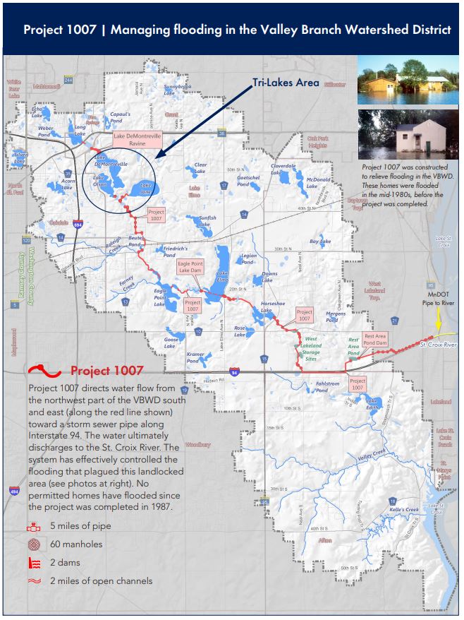
Today, “Project 1007,” a $4.25 million flood-prevention project completed in 1987, links the formerly land-locked lakes in the northwest and central portions of the Valley Branch watershed to a large storm sewer pipe along Interstate 94 that discharges to the St. Croix River. The intricate system includes five miles of pipe, 60 manholes, two dams, and two miles of open channels designed to provide a safe route for water to overflow without endangering homes and roads. Elsewhere within the district, however, there are smaller land-locked basins, not connected to this system, that are prone to flooding during high water years. Such was the case in 2020.
Though this year brought us record drought, 2020 was actually marked by extremely high water levels resulting from seven years of abnormally wet weather. With surficial groundwater aquifers filled to brimming, and lakes, rivers, and wetlands high as well, there was nowhere for the water to go when the region received 15 inches of rain over a three week period of time in the early summer. It was a logistical challenge for the Valley Branch Watershed District, as they worked to relieve flooding in affected neighborhoods, without sending water downstream into others.
To protect homes in land-locked basins, the district built an emergency conveyance system to pump water out, taking care not to overwhelm any other water bodies or drainage systems during the process. As they worked, Valley Branch staff had to coordinate closely with two counties, fifteen cities and townships, and five adjacent watershed management organizations. This required intensive communication with landowners and local government partners, as well as constant monitoring of equipment, water levels, and water quality for water being pumped out to downstream locations. The district also acquired flood damage reduction grant funding from the DNR to buy-out a few homes in flood-prone locations.
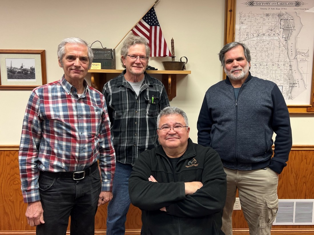
“It was quite a surprise to hear that Valley Branch had been selected for the DNR’s ‘Watershed District of the Year Award’,” says John Hanson of Barr Engineering, who has served as the watershed district’s engineer for twenty years. The announcement was made on December 2, during the Minnesota Association of Watershed Districts Annual Conference. Looking toward the future, however, the watershed district continues its focus on flooding and is working to complete a comprehensive study of flood mitigation within land-locked basins.

The Valley Branch Watershed District covers one square mile of Ramsey County and 70 square miles of Washington County, containing Valley Creek, Belwin Land Conservancy, Lake Elmo Regional Park, Sunfish Lake Park, the Tri-Lakes, Oakdale Nature Preserve, and Silver Lake in North St. Paul. Learn about its programs and projects at www.vbwd.org.

Thanks for sending this Angie! Our house is on one of those landlocked bodies of water. We were told that the only solution for us was to sand bag or build a berm. So we built a berm and planted it with native plants. Bonnie Juran Klawitter Pond
On Thu, Dec 23, 2021 at 9:19 AM East Metro Water wrote:
> angiehongmn posted: ” It was February 2020, and staff and officials from > local communities were packed into a room at the Washington County > Government Center, some sitting on the floor, others leaning against the > back wall with notebooks propped against their stomachs. The gr” >
LikeLike