
This February, the Minnesota Pollution Control Agency (MPCA) released an updated list of lakes, rivers and streams in our state that are officially classified as impaired. Some no longer support the fish and insect species that they used to. Others are prone to frequent algae blooms due to too much nutrients in the water. Still others have fish consumption advisories due to high levels of mercury, PCBs or PFOS. In total, 2904 water bodies in Minnesota are considered impaired.

Though it is easy to feel frustrated and discouraged when we see our favorite water bodies affected by pollution, 2022 brings good news as well. Fifty-three lakes and streams in Minnesota have improved enough that they were actually taken OFF of the impaired waters list (de-listed) in 2022. In fact, since 2002, 184 water bodies in Minnesota have been removed from the impaired waters list due to improved water quality.
Who tracks water quality in the Forest Lake area, and how do we nurse impaired lakes and streams back to good health?
The City of Forest Lake rests on a divide between the Comfort Lake – Forest Lake (CLFLWD) and Rice Creek (RCWD) Watersheds. Water from Clear Lake flows out through Mud Lake, Howard Lake, the Rice Creek Chain of Lakes, and eventually on to the Mississippi River. From Forest Lake, water flows out through the Sunrise River and Comfort Lake, before continuing onward to the St. Croix River. Both watershed districts operate monitoring programs for lakes and streams within their jurisdiction. They also utilizing volunteer programs such as Citizen Assisted Tributary Monitoring Program (CLFLWD), Citizen Assisted Monitoring Program (CLFLWD and RCWD), and the Stream Health Evaluation Project (RCWD).

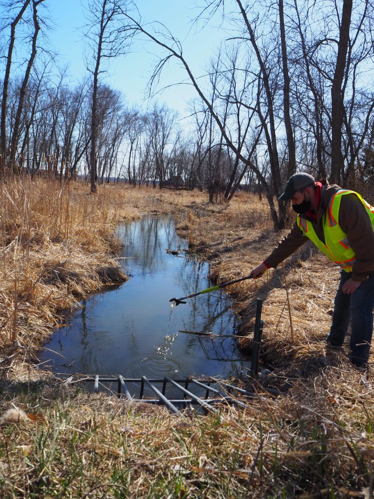
In December, the Minnesota Association of Watershed Districts recognized CLFLWD’s Citizen Assisted Tributary Monitoring Program as its 2021 Program of the Year. The program utilizes trained volunteers to collect water samples at small and flashy drainage points surrounding selected lakes, and then deliver those samples to the CLFLWD for analysis using inexpensive, yet accurate, digital colorimeters. The program is a low-cost screening tool (about $12 per sample) that complements the more expensive full-scale diagnostic efforts conducted by watershed district staff and engineers.
Water monitoring data helps watershed managers to better understand where pollutants are coming from and where to target water quality improvement projects in the future. Then, after completing pollution-reduction projects such as restoring wetlands or building ponds to capture and reuse stormwater runoff for irrigation, volunteers and staff continue monitoring sites to determine whether water quality is improving.
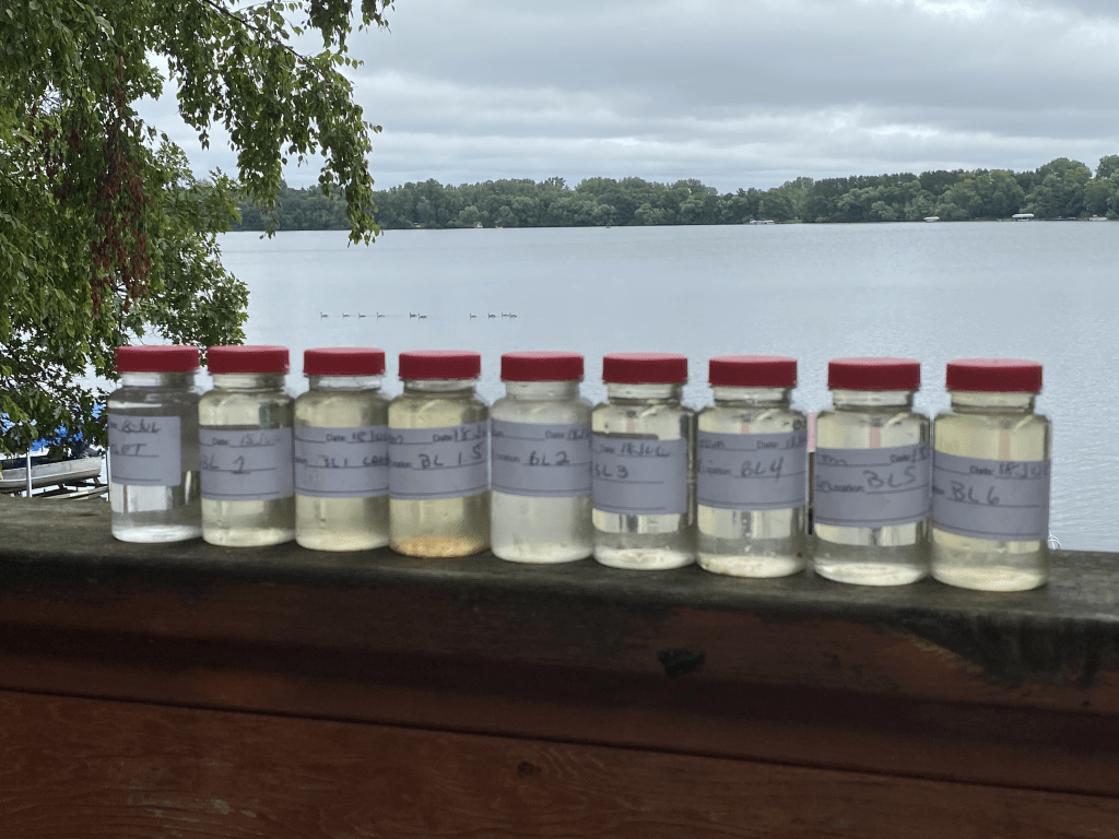
Volunteers also help to collect lake water quality data for both watershed districts. On a bi-weekly basis (April-October), each volunteer collects a surface water sample for lab analysis to measure total phosphorus, total nitrogen, and chlorophyll-a. They also measure temperature and water clarity, and record observations about the lake’s physical and recreational condition.
Interested in learning more about water monitoring or volunteering in the Forest Lake area?
- To become a lake monitoring volunteer, contact Garrett Miller at garrett.miller@clflwd.org or 651-395-5854 (Forest, Keewatin, and Shields Lakes) or Matthew Kocian at mkocian@ricecreek.org or 763-398-3075 (Clear or Mud Lake).
- To learn more about the CLFLWD citizen tributary monitoring program, contact Trey Jonas at trey.jonas@clflwd.org or 651-395-5852. Training and supplies are provided for all volunteers.
- To participate in other programs offered by Comfort Lake-Forest Lake Watershed District, contact info@clflwd.org.
- To find a full list and map of impaired waters in Minnesota, go to www.pca.state.mn.us/water/minnesotas-impaired-waters-list.
